Mapping The Eternal City
A monumental work provides an architectural and topographical survey of Rome from its foundation until the century after the fall of its Empire.
 The Atlas of Rome is a landmark in the long history of mapping the Eternal City. It provides a digitally produced contribution to a venerable tradition that reaches back to Rodolfo Lanciani in the 19th century and Giambattista Nolli a century earlier. Like those pioneering works, this Atlas integrates archaeological and topographical information on a city-wide scale to create something beautiful. It condenses extremely complex information into a series of region-by-region essays, accompanied by hundreds of colour-coded maps and diagrams.
The first of the Atlas’ two volumes gives an introduction to the project’s goals and methodology. It then presents chapters that consider elements of ancient Rome as a whole: its natural and historic landscapes, infrastructure, burial grounds, economic life and the city’s extraordinary collapse. Further chapters chart the development of the 14 regions into which the first emperor, Augustus, divided the city. Each one of these chapters contains a short introduction followed by a dense, chronological account of monuments constructed between around 1050 bc and ad 553. These generously illustrated accounts give a lively sense of change over the centuries. A reader interested in a specific monument, perhaps wanting to know why it is depicted in a particular way, will therefore be able to trace its development over time through the text. This arrangement complements rather than replaces existing topographical dictionaries of Rome.
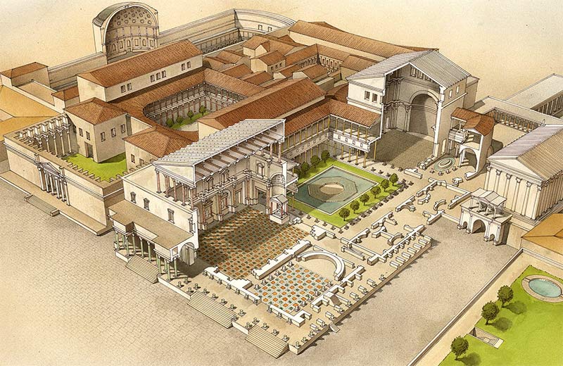
The second volume contains hundreds of beautifully rendered maps and illustrations, based on the Atlas project’s database of information. It is one of the most beautiful academic books I have ever seen, making an enormous visual contribution to the historical study of Roman topography and architecture. It is meticulously produced and packed with rich visual and verbal information that justifies its price.
Eighteen tables mapping elements of the city as a whole, or giving visual glossaries of building techniques and terms, are followed by 284 illustrations detailing individual monuments or complexes. These use different colours for different types of source material and include ground plans, elevations, sections, photographs of surviving elements, annotations about literary sources and reconstructions. The density of information packed into these pages is outstanding and repays careful perusal rather than a quick glance.
There follows a series of 37 1:2,000 scale tables that make up a map of the city in the early fourth century ad, which is overlaid on a modern map of the city.
The English edition of the Atlas incorporates the latest archaeological information, including buildings found during the current construction of Rome’s third metro line. As with any act of reconstruction or mapping on this scale, gaps in the evidence have to be filled in by speculation. Given the complexity of the questions involved and the fact that little survives of even some major structures (as coloured keys to many of the maps reveal), opinions on how to reconstruct them differ. Not all the judgments proposed by the Atlas will be universally accepted; its vision of early Rome, for example, is coloured by a faith in legendary accounts – the story of Romulus and Remus and the early kings, for instance – which is not universally shared.
Overall, though, this is a monumental piece of scholarship and I hope that the work on which it is based will find further expression: an online resource would present its huge archive of digital information without the constraints inherent in a printed volume. This does not take away from the achievement of the volumes reviewed here. The book design and production are marvellous and the result is an invaluable account of the complex archaeology of the Eternal City.
The Atlas of Rome: Biography and Portraits of the City
Andrea Carandini (ed), with Paolo Carafa
Princeton, two vols
1,280pp £148.95
Matthew Nicholls is Associate Professor in the Department of Classics at the University of Reading and has developed and runs the university’s online Virtual Rome project.


