Putting America On The Map
A German map published in 1507 was the first to name the continent.

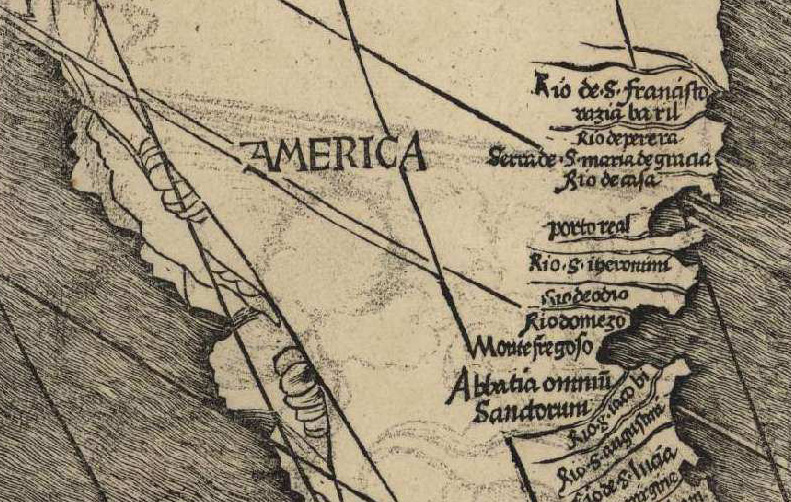
In April 1507, 15 years after Columbus landed on the island of Hispaniola and became the first documented European to reach the Americas, the German cartographers Martin Waldseemüller and Matthias Ringmann published a map that attempted to reflect the dramatic geographical discoveries of the era.
Titled Universalis Cosmographia, the vast map measured eight feet across and was the result of a multi-year project that used information provided from many different sources, among them the voyages of Amerigo Vespucci, a Florentine explorer who in 1501-02 sailed down the coast of South America. Vespucci was also said to have sailed to Brazil in 1497, a claim that was almost certainly untrue but one that the publicity-hungry explorer was keen to exploit. It worked: in 1503 Ringmann spent some time in Italy, where Vespucci's exploits were a popular topic, and when the time came to annotate the map, they labelled the continent 'America' in the Italian's honour. Though the cartographers later realised their mistake ('America' was gone from an updated version published in 1513), the name stuck.

Beyond this the map was also significant for several other reasons: it posited the existence of the Pacific Ocean, unknown to Europeans at the time, and also gave a detailed impression of the African coastline.
Despite its historical significance, the Waldseemüller map quickly faded from view in the 16th century. 1,000 copies were reproduced but as more and more cartographers visited the Americas it quickly became obsolete. The sole surviving copy was purchased for $10m in 2003 by the Library of Congress.


